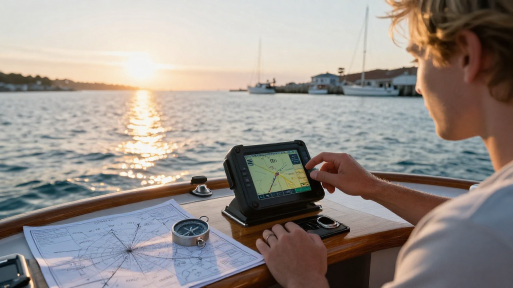
Updating your marine GPS charts for accuracy is essential for safe and efficient navigation on the water.
In this article, we will explore the steps you need to take to ensure your marine GPS charts are consistently accurate and reliable.
Why Is It Important to Update Marine GPS Charts?
Marine GPS charts are critical tools for boaters, fishermen, and maritime professionals.
Outdated charts can lead to serious navigation errors, such as:
- Running aground in shallow waters
- Colliding with submerged structures
- Missing hazards due to lack of updated information
With continually changing water levels, shifts in navigation aids, and the introduction of new marine developments, accurate charts are not just recommended—they are essential.
So, how to update marine GPS charts effectively? Let’s dive into the steps required.
What Are the Different Sources of Updates for Marine GPS Charts?
Before you start the updating process, it’s essential to understand where your updates can come from.
Updates for marine GPS charts can be sourced from various areas, including:
- Official Hydrographic Offices: Many countries have official hydrographic offices that publish and distribute new charts.
- Navionics and C-MAP: These popular chart providers offer regularly updated digital charts and apps to ensure you’re sailing on the most accurate maps.
- Community Reports: Local marinas and boating organizations often share warnings about conditions and hazards in specific areas.
- USCG Notices to Mariners: The United States Coast Guard regularly publishes changes affecting navigation that should be reviewed.
Knowing where to obtain your updates is crucial for maintaining accuracy.
How to Update Marine GPS Charts Step-by-Step?
Once you have your sources identified, the next question becomes: how to update marine GPS charts effectively?
Here’s a comprehensive, step-by-step guide to help you update your marine GPS charts:
1. Backup Your Current Charts
Before making any changes, create a backup of your existing charts. This ensures you have access to them in case anything goes wrong during the update process.
You can save backups on a USB stick, external hard drive, or a cloud storage service.
2. Access the Update Method
Depending on your chart source, you will need to determine how to receive your updates:
-
Downloadable Updates: If you use digital charts, visit your provider’s website (such as Navionics or C-MAP) and check for updates available for download.
-
Physical Updates: If you’re using paper charts, reach out to your hydrographic office or local marine supply store for the latest editions.
-
Mobile Apps: If you’re using an application on your smartphone or tablet, regularly check for app updates in your device’s app store.
3. Install the Updates
After obtaining the latest charts, it’s time to install them:
-
Digital Charts: For digital updates, follow the provider’s specific installation instructions. This often involves installing new files onto your GPS system or SD card.
-
Paper Charts: Replace any outdated paper charts with their updated versions and discard the old ones responsibly.
-
Syncing Devices: If you use multiple devices, ensure they are all synced with the latest chart versions.
4. Review Newly Added Information
After installation, take some time to review the new information on your charts. Look for:
- Updated navigation aids
- New underwater structures
- Shifts in navigational routes or channels
This review will help you integrate new data into your sailing routines and strategies.
5. Regular Updates Are Key
Updating your marine GPS charts should not be a one-time event. It is advisable to plan regular updates:
- Monthly or Quarterly: Depending on your usage, consider updating your charts monthly or quarterly.
- Before Major Trips: Always check for updates before embarking on a long voyage.
Ensuring your charts are current is vital for safe navigation.
Can I Use Free Resources to Update Marine GPS Charts?
Yes, you can use certain free resources to assist in updating your marine GPS charts.
Some options include:
- Government websites: Many countries provide free access to updated charts and notices.
- Crowdsourced Apps: Platforms like OpenSeaMap allow users to report and update marine information, including navigational hazards.
- Marina Notices: Local marinas may offer bulletin boards or newsletters with recent changes in local waters.
How Often Should I Check for Updates?
It’s recommended to check for updates at least once a month or before any significant trip.
What Types of Charts Should I Update?
You should consider updating the following types of charts regularly:
- Navigational Charts: These are essential for safe passage through coastal and inland waters.
- Fishing Charts: Often include specific depths and fishing spots useful for anglers.
- Cruising Guides: Helpful for discovering new areas with points of interest and navigation tips.
Staying informed about various chart types enhances your boating experience.
What Are Common Mistakes to Avoid When Updating Marine GPS Charts?
When updating your marine GPS charts, avoid these common mistakes:
- Neglecting Backups: Always backup your data before updating.
- Ignoring Notifications: Failing to read notices and updates can lead to dangerous situations.
- Delay in Updates: Waiting too long to update can lead to outdated navigation information.
Awareness and preparation are your best friends in maintaining accurate marine GPS charts.
Conclusion
In conclusion, knowing how to update marine GPS charts is an essential skill for any mariner.
Accurate marine navigation relies on staying current with updates from reliable sources.
From regular backups and careful installations to the review of newly-added information, your diligence ensures safe and enjoyable boating adventures.
By incorporating these tips, you’ll enhance your navigation accuracy significantly.
So, don’t wait—get started on updating your marine GPS charts today and set sail with confidence!